| Published in Weather / South Dakota Weather Temperature |
Weather in Spearfish / Clyde Ice, South Dakota
Current Conditions (Friday, January 31, 2025 at 21:55 America/Denver time)
Temperature: 45°F (7°C) |
Forecast Overview
Sat Feb 1 
48°F 34°F 9°C 1°C Considerable cloudiness.
detailsSun Feb 2 
34°F 18°F 1°C -8°C Chance of snow at various times.
detailsMon Feb 3 18°F 5°F -8°C -15°C Chance of snow all night and day.
detailsTue Feb 4 14°F 5°F -10°C -15°C Chance of light snow at various times.
detailsWed Feb 5 
30°F 5°F -1°C -15°C Mostly cloudy skies.
detailsThu Feb 6 
23°F 9°F -5°C -13°C A few passing clouds.
detailsFri Feb 7 
25°F 12°F -4°C -11°C Chance of light snow in the afternoon.
detailsSat Feb 8 23°F 7°F -5°C -14°C Chance of light snow all day.
detailsSun Feb 9 
18°F 5°F -8°C -15°C Chance of light snow before sunrise.
details
Detailed Forecast
| Saturday, February 1 | sunrise: 07:15 sunset: 17:02 |
| Low around 34°F (1°C), high around 48°F (9°C). Estimated precipitation: 0 in (0.0625 mm). Considerable cloudiness. Wind: 18 mph (29 km/h). |
| Time | Skies | Conditions | Temp | Wind | Humidity | Soil Moisture |
| 23:00 02:00 | Overcast. | 36°F (2°C) | 6 mph (10 km/h) | 55% | 0.349% | |
| 02:00 05:00 | Times of clear skies and clouds. | 36°F (2°C) | 9 mph (15 km/h) | 63% | 0.347% | |
| 05:00 08:00 | Partly cloudy. | 38°F (3°C) | 9 mph (14 km/h) | 64% | 0.345% | |
| 08:00 11:00 | Sunny. | 46°F (8°C) | 18 mph (29 km/h) | 49% | 0.342% | |
| 11:00 14:00 | Sunny. | 48°F (9°C) | 15 mph (23 km/h) | 46% | 0.328% | |
| 14:00 17:00 | Overcast. | 39°F (4°C) | 6 mph (10 km/h) | 57% | 0.316% | |
| 17:00 20:00 | Overcast. | 35°F (1°C) | 6 mph (10 km/h) | 67% | 0.308% | |
| 20:00 23:00 | Partly cloudy. Precipitation: 0 in (0.0625 mm). | 35°F (2°C) | 7 mph (12 km/h) | 65% | 0.304% |
| Sunday, February 2 | sunrise: 07:14 sunset: 17:04 |
| Low around 17°F (-8°C), high around 34°F (1°C). Chance of snow before sunrise (between 2 am and 5 am) and in the evening (after 5 pm). Estimated precipitation: 0.13 in (3.1875 mm). Overcast skies. Wind: 16 mph (26 km/h). |
| Time | Skies | Conditions | Temp | Wind | Humidity | Soil Moisture |
| 23:00 02:00 | Overcast. | 31°F (-0°C) | 7 mph (11 km/h) | 93% | 0.3% | |
| 02:00 05:00 | Chance of light snow. Precipitation: 0.02 in (0.5 mm). | 28°F (-2°C) | 11 mph (18 km/h) | 92% | 0.297% | |
| 05:00 08:00 | Overcast. Precipitation: 0.02 in (0.4375 mm). | 23°F (-5°C) | 9 mph (14 km/h) | 86% | 0.295% | |
| 08:00 11:00 | Overcast. Precipitation: 0 in (0.125 mm). | 23°F (-5°C) | 7 mph (12 km/h) | 70% | 0.293% | |
| 11:00 14:00 | Overcast. Precipitation: 0.01 in (0.25 mm). | 24°F (-4°C) | 8 mph (13 km/h) | 65% | 0.291% | |
| 14:00 17:00 | Overcast. Precipitation: 0.01 in (0.3125 mm). | 22°F (-5°C) | 11 mph (18 km/h) | 65% | 0.289% | |
| 17:00 20:00 | Chance of light snow. Precipitation: 0.01 in (0.3125 mm). | 19°F (-7°C) | 15 mph (23 km/h) | 91% | 0.288% | |
| 20:00 23:00 | Chance of snow. Precipitation: 0.05 in (1.25 mm). | 18°F (-8°C) | 16 mph (26 km/h) | 92% | 0.289% |
| Monday, February 3 | sunrise: 07:12 sunset: 17:05 |
| Low around 6°F (-15°C), high around 18°F (-8°C). Chance of snow all night and day. Estimated precipitation: 0.28 in (7.1875 mm). Overcast skies. Wind: 13 mph (21 km/h). |
| Time | Skies | Conditions | Temp | Wind | Humidity | Soil Moisture |
| 23:00 02:00 | Chance of light snow. Precipitation: 0.03 in (0.8125 mm). | 17°F (-9°C) | 13 mph (21 km/h) | 93% | 0.289% | |
| 02:00 05:00 | Chance of snow. Precipitation: 0.04 in (1.0625 mm). | 12°F (-11°C) | 11 mph (17 km/h) | 94% | 0.289% | |
| 05:00 08:00 | Chance of snow. Precipitation: 0.07 in (1.8125 mm). | 8°F (-14°C) | 9 mph (14 km/h) | 94% | 0.29% | |
| 08:00 11:00 | Chance of snow. Precipitation: 0.07 in (1.8125 mm). | 9°F (-13°C) | 8 mph (13 km/h) | 90% | 0.291% | |
| 11:00 14:00 | Chance of light snow. Precipitation: 0.03 in (0.6875 mm). | 10°F (-12°C) | 8 mph (13 km/h) | 90% | 0.292% | |
| 14:00 17:00 | Chance of light snow. Precipitation: 0.02 in (0.5625 mm). | 7°F (-14°C) | 8 mph (13 km/h) | 95% | 0.293% | |
| 17:00 20:00 | Chance of light snow. Precipitation: 0.01 in (0.3125 mm). | 6°F (-15°C) | 8 mph (12 km/h) | 96% | 0.294% | |
| 20:00 23:00 | Chance of light snow. Precipitation: 0 in (0.125 mm). | 6°F (-14°C) | 10 mph (15 km/h) | 95% | 0.296% |
| Tuesday, February 4 | sunrise: 07:11 sunset: 17:07 |
| Low around 5°F (-15°C), high around 14°F (-10°C). Chance of light snow before sunrise (from 11 pm to 5 am), in the afternoon and in the evening (from 11 am to 8 pm). Estimated precipitation: 0.04 in (1 mm). Mostly cloudy skies. Wind: 14 mph (22 km/h). |
| Time | Skies | Conditions | Temp | Wind | Humidity | Soil Moisture |
| 23:00 02:00 | Chance of light snow. Precipitation: 0 in (0.0625 mm). | 6°F (-14°C) | 11 mph (18 km/h) | 95% | 0.297% | |
| 02:00 05:00 | Chance of light snow. Precipitation: 0.01 in (0.1875 mm). | 6°F (-15°C) | 12 mph (19 km/h) | 95% | 0.298% | |
| 05:00 08:00 | Overcast. Precipitation: 0 in (0.0625 mm). | 6°F (-14°C) | 12 mph (19 km/h) | 92% | 0.299% | |
| 08:00 11:00 | Overcast. Precipitation: 0 in (0.0625 mm). | 12°F (-11°C) | 14 mph (22 km/h) | 86% | 0.3% | |
| 11:00 14:00 | Chance of light snow. Precipitation: 0 in (0.125 mm). | 14°F (-10°C) | 14 mph (22 km/h) | 89% | 0.301% | |
| 14:00 17:00 | Chance of light snow. Precipitation: 0.01 in (0.25 mm). | 10°F (-12°C) | 12 mph (19 km/h) | 96% | 0.302% | |
| 17:00 20:00 | Chance of light snow. Precipitation: 0.01 in (0.1875 mm). | 7°F (-14°C) | 9 mph (14 km/h) | 97% | 0.303% | |
| 20:00 23:00 | A few passing clouds. Precipitation: 0 in (0.0625 mm). | 6°F (-15°C) | 7 mph (12 km/h) | 96% | 0.304% |
| Wednesday, February 5 | sunrise: 07:10 sunset: 17:08 |
| Low around 4°F (-15°C), high around 30°F (-1°C). Chance of light snow late in the afternoon (between 2 pm and 5 pm). Chance of light, freezing rain early in the afternoon (between 11 am and 2 pm). Estimated precipitation: 0.03 in (0.6875 mm). Mostly cloudy skies. Wind: 19 mph (31 km/h). |
| Time | Skies | Conditions | Temp | Wind | Humidity | Soil Moisture |
| 23:00 02:00 | Partly cloudy. Precipitation: 0 in (0.0625 mm). | 5°F (-15°C) | 6 mph (10 km/h) | 97% | 0.305% | |
| 02:00 05:00 | Overcast. | 6°F (-14°C) | 5 mph (9 km/h) | 98% | 0.307% | |
| 05:00 08:00 | Overcast. Precipitation: 0 in (0.0625 mm). | 11°F (-12°C) | 4 mph (7 km/h) | 98% | 0.308% | |
| 08:00 11:00 | Overcast. Precipitation: 0 in (0.0625 mm). | 26°F (-3°C) | 8 mph (13 km/h) | 86% | 0.309% | |
| 11:00 14:00 | Possibly freezing rain leading to formation of glaze ice. Precipitation: 0 in (0.0625 mm). | 25°F (-4°C) | 12 mph (20 km/h) | 91% | 0.31% | |
| 14:00 17:00 | Chance of light snow. Precipitation: 0.01 in (0.375 mm). | 13°F (-11°C) | 16 mph (26 km/h) | 93% | 0.311% | |
| 17:00 20:00 | Considerable cloudiness. | 9°F (-13°C) | 19 mph (31 km/h) | 88% | 0.312% | |
| 20:00 23:00 | Clear. Precipitation: 0 in (0.0625 mm). | 9°F (-13°C) | 12 mph (20 km/h) | 73% | 0.313% |
| Thursday, February 6 | sunrise: 07:09 sunset: 17:09 |
| Low around 8°F (-13°C), high around 23°F (-5°C). A few passing clouds. Wind: 18 mph (29 km/h). |
| Time | Skies | Conditions | Temp | Wind | Humidity | Soil Moisture |
| 23:00 02:00 | Clear. | 12°F (-11°C) | 10 mph (16 km/h) | 64% | 0.314% | |
| 02:00 05:00 | Overcast. | 17°F (-8°C) | 16 mph (26 km/h) | 61% | 0.315% | |
| 05:00 08:00 | Sunny. | 11°F (-12°C) | 13 mph (21 km/h) | 76% | 0.316% | |
| 08:00 11:00 | Sunny. | 20°F (-7°C) | 18 mph (29 km/h) | 64% | 0.317% | |
| 11:00 14:00 | Sunny. | 23°F (-5°C) | 17 mph (28 km/h) | 65% | 0.318% | |
| 14:00 17:00 | Sunny. | 16°F (-9°C) | 8 mph (12 km/h) | 79% | 0.319% | |
| 17:00 20:00 | Clear. | 12°F (-11°C) | 6 mph (10 km/h) | 76% | 0.32% | |
| 20:00 23:00 | Partly cloudy. | 16°F (-9°C) | 6 mph (9 km/h) | 72% | 0.32% |
| Friday, February 7 | sunrise: 07:07 sunset: 17:11 |
| Low around 13°F (-11°C), high around 25°F (-4°C). Chance of light snow late in the afternoon (between 2 pm and 5 pm). Estimated precipitation: 0.05 in (1.3125 mm). Overcast skies. Wind: 11 mph (18 km/h). |
| Time | Skies | Conditions | Temp | Wind | Humidity | Soil Moisture |
| 23:00 02:00 | Overcast. | 15°F (-10°C) | 5 mph (7 km/h) | 74% | 0.321% | |
| 02:00 05:00 | Overcast. | 20°F (-7°C) | 7 mph (11 km/h) | 75% | 0.322% | |
| 05:00 08:00 | Overcast. | 18°F (-8°C) | 4 mph (6 km/h) | 82% | 0.323% | |
| 08:00 11:00 | Overcast. | 24°F (-5°C) | 9 mph (14 km/h) | 76% | 0.323% | |
| 11:00 14:00 | Overcast. | 24°F (-4°C) | 10 mph (16 km/h) | 80% | 0.324% | |
| 14:00 17:00 | Chance of light snow. Precipitation: 0 in (0.125 mm). | 19°F (-7°C) | 11 mph (18 km/h) | 95% | 0.324% | |
| 17:00 20:00 | Mostly cloudy. Precipitation: 0.03 in (0.8125 mm). | 17°F (-8°C) | 9 mph (14 km/h) | 94% | 0.325% | |
| 20:00 23:00 | Overcast. Precipitation: 0.01 in (0.375 mm). | 16°F (-9°C) | 5 mph (8 km/h) | 96% | 0.325% |
| Saturday, February 8 | sunrise: 07:06 sunset: 17:12 |
| Low around 6°F (-14°C), high around 23°F (-5°C). Chance of light snow most of the day (after 5 am). Estimated precipitation: 0.07 in (1.6875 mm). Mostly cloudy skies. Wind: 12 mph (19 km/h). |
| Time | Skies | Conditions | Temp | Wind | Humidity | Soil Moisture |
| 23:00 02:00 | Overcast. Precipitation: 0 in (0.125 mm). | 13°F (-10°C) | 4 mph (7 km/h) | 98% | 0.326% | |
| 02:00 05:00 | Mostly cloudy. | 10°F (-12°C) | 2 mph (4 km/h) | 99% | 0.327% | |
| 05:00 08:00 | Chance of light snow. Precipitation: 0 in (0.0625 mm). | 11°F (-12°C) | 2 mph (4 km/h) | 96% | 0.327% | |
| 08:00 11:00 | Chance of light snow. Precipitation: 0 in (0.0625 mm). | 18°F (-8°C) | 7 mph (11 km/h) | 92% | 0.328% | |
| 11:00 14:00 | Chance of light snow. Precipitation: 0 in (0.125 mm). | 22°F (-6°C) | 12 mph (19 km/h) | 89% | 0.328% | |
| 14:00 17:00 | Chance of light snow. Precipitation: 0.02 in (0.5 mm). | 17°F (-8°C) | 9 mph (15 km/h) | 95% | 0.329% | |
| 17:00 20:00 | Chance of light snow. Precipitation: 0.02 in (0.5625 mm). | 13°F (-11°C) | 6 mph (9 km/h) | 95% | 0.33% | |
| 20:00 23:00 | Chance of light snow. Precipitation: 0.01 in (0.25 mm). | 8°F (-13°C) | 6 mph (9 km/h) | 96% | 0.33% |
| Sunday, February 9 | sunrise: 07:05 sunset: 17:14 |
| Low around 5°F (-15°C), high around 17°F (-8°C). Chance of light snow before sunrise (from 11 pm to 5 am). Estimated precipitation: 0.01 in (0.375 mm). Mostly cloudy skies. Wind: 6 mph (9 km/h). |
| Time | Skies | Conditions | Temp | Wind | Humidity | Soil Moisture |
| 23:00 02:00 | Chance of light snow. Precipitation: 0 in (0.0625 mm). | 9°F (-13°C) | 5 mph (8 km/h) | 95% | 0.33% | |
| 02:00 05:00 | Chance of light snow. Precipitation: 0 in (0.0625 mm). | 7°F (-14°C) | 4 mph (6 km/h) | 97% | 0.331% | |
| 05:00 08:00 | Overcast. | 9°F (-13°C) | 3 mph (5 km/h) | 93% | 0.332% | |
| 08:00 11:00 | Overcast. Precipitation: 0 in (0.0625 mm). | 13°F (-10°C) | 5 mph (8 km/h) | 88% | 0.332% | |
| 11:00 14:00 | Overcast. | 17°F (-8°C) | 6 mph (9 km/h) | 86% | 0.332% | |
| 14:00 17:00 | Overcast. Precipitation: 0 in (0.125 mm). | 13°F (-10°C) | 3 mph (5 km/h) | 96% | 0.333% | |
| 17:00 20:00 | Times of clear skies and clouds. | 7°F (-14°C) | 4 mph (7 km/h) | 97% | 0.333% | |
| 20:00 23:00 | Times of clear skies and clouds. Precipitation: 0 in (0.0625 mm). | 5°F (-15°C) | 3 mph (5 km/h) | 95% | 0.334% |
Climate Chart
» Spearfish / Clyde Ice Climate Chart
Places with a similar climate: Buffalo Johnson County (WY), Cody (WY), Gillette, Campbell County (WY), Rapid City (SD), Great Falls (MT), Rapid City, Meade County (SD).
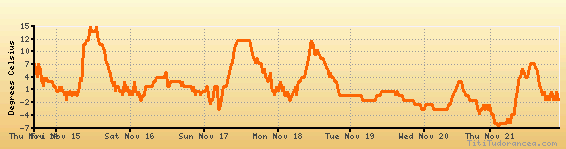
Temperature variation graph for the last seven days
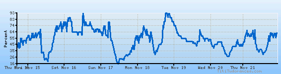
Humidity Variation Graph
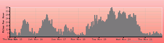
Wind speed
Weather Station: Spearfish / Clyde Ice (latitude 44-29N, longitude 103-47W)
Local Time:
Spearfish / Clyde Ice is in the "America/Denver" timezone.
The "America/Denver" timezone uses a Standard Time (ST) / Daylight Saving Time (DST) alternation scheme, and it currently is in ST (since Sunday, 3 November 2024, 01:00 AM local time). During ST, the timezone abbreviation is MST and the offset to Universal Time (UTC, GMT or Zulu) is -7:00 hours.
Spearfish / Clyde Ice will exit standard time (entering DST) on Sunday, 9 March 2025, at 02:00 AM local time, when clocks will be turned forward 1 hour to Sunday, 9 March 2025, 03:00 AM local daylight time. During DST, the timezone abbreviation is MDT and the offset to UTC will be -6:00 hours.
Weather and Temperature in South Dakota
Popular Weather Searches:
 If you own or manage a travel-related business such as a hotel, a bed-and-breakfast, a restaurant, a pub or a cafeteria, you can create a web page for your business for free on Titi Tudorancea Travel Info. » |