| Published in Tourist Info / Highways |
Bundesautobahn 4, Germany
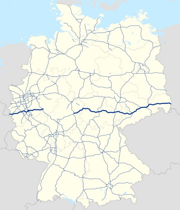
Map of Bundesautobahn 4, Germany. ![]()
Bundesautobahn 4 (Federal Motorway 4, short form Autobahn 4, abbreviated as BAB 4 or A 4) is an autobahn that crosses Germany in a west–east direction. The western segment has a length of 156 km (97 mi), the part in the east is 429 km (267 mi) long.
Works to continue the A 4 are in progress, but currently no plans exist to fill the gap completely.
The A 4 starts north-west of Aachen, where the Dutch A76 enters Germany. Initially it is 2 lanes each way with no speed limit. From Kreuz Aachen to Düren and from Kerpen to Refrath (between Refrath and Köln-Merheim westbound the hard shoulder is the 3rd lane and only open at peak times) it has 3 lanes each way.
Between Kreuz Köln-West and Kreuz Heumar it forms the southern part of the Cologne Beltway (Kölner Autobahnring). The whole rest of the section between Kreuz Aachen and Kreuz Köln-West has a variable speed limit.
Between Merzenich and Elsdorf, there is a speed limit of 130 km/h, that has been imposed in 2017, due to an increase of accidents.
Between Kreuz Köln-West and Kreuz Heumar the speed limit is 120 km/h. From Kreuz Köln-Ost to Refrath there is a maximum limit of 100 km/h.
The westbound section between Köln-Merheim and Kreuz Köln-Ost is restricted to 80 km/h. The section between Refrath and the current terminus at Krombach has no speed limit. Only between Untereschbach and Refrath westbound there is a 100 km/h speed limit from 6 - 10 am on weekdays.
It is mostly 2 lanes each way, but between Untereschbach and Wiehl there are several additional climbing lanes in both directions.
The eastern part starts at the Kirchheim intersection (with the A 7) and goes through Eisenach, Gotha, Erfurt, Weimar, Jena, Gera, Chemnitz and Dresden to Görlitz, where it crosses the border to Poland and continues as A4 (Poland).
The westernmost 11 kilometers of the A 4 form the most easterly stretch of the European route E314: continuing east from the Aachen interchange (Kreuz Aachen), the A 4 is part of the European route E40. European routes don't have gaps and E40 follows A 45 and A 5, which is a suitable route past the gap of A 4.
The first sections of the A 4 were built in the years 1934 to 1937. Because it crossed the border between East and West Germany several times, those parts were closed and fell into decay during the time of German division. Repairs of those parts are scheduled to be completed in 2007.
Reconstruction of last section in Thuringia between Eisenach and Gotha near the former Inner German Border began in 2007 and required building 25 km (16 mi) of new road. Vinci SA and Hochtief were the contracted to build the new road.
Length: 616 km (383 mi)
States: North Rhine-Westphalia, Hesse, Saxony, Thuringia
Source
• www.wikipedia.org
YOU MAY ALSO LIKE


 If you own or manage a travel-related business such as a hotel, a bed-and-breakfast, a restaurant, a pub or a cafeteria, you can create a web page for your business for free on Titi Tudorancea Travel Info. » |