| Published in Tourist Info / Highways |
Bundesautobahn 45, Germany
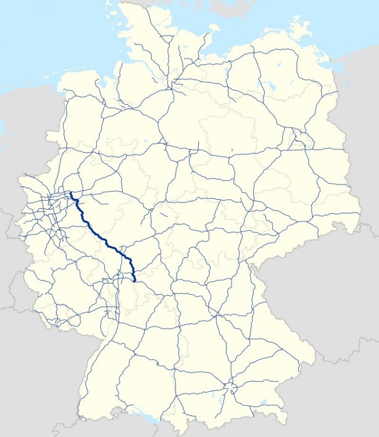
Map of Bundesautobahn 45, Germany. ![]()
Bundesautobahn 45 (Federal Motorway 45, short form Autobahn 45, abbreviated as BAB 45 or A 45) is an autobahn in Germany, connecting Dortmund in the west with Aschaffenburg in the southwest. It is colloquially known as the Sauerlandlinie (Sauerland line) as it runs through the hilly, rural Sauerland region between Hagen and Siegen.
The A45 has many bridges to cross valleys, the highest of which is the Sichter Valley bridge (Talbrücke Sichter) between Lüdenscheid and Meinerzhagen at 530 metres above mean sea level. It is mostly two lanes each way with frequent climbing lanes between Dortmund-Hafen and the Gambacher Kreuz intersection.
The A 45 branches off the A 2 at the Dortmund Nord-West intersection, passes through the eastern Ruhr area and enters the Sauerland near Hagen. It then enters the Siegerland and the state of Hesse, where the A 45 is joined by the A 66 between the interchanges Hanauer Kreuz and Langenselbolder Dreieck.
A short stretch of road, between junctions Alzenau and Mainhausen, is on Bavarian territory, then the A 45 merges with the A 3 at the interchange Seligenstädter Dreieck in the state of Hesse, just to the west of the Bavarian city of Aschaffenburg.
Length: 257 km (160 mi)
Junctions
North end: A 2 in Dortmund
South end: A 3 in Seligenstadt
States: North Rhine-Westphalia, Hesse, Bavaria
Source
• www.wikipedia.org
YOU MAY ALSO LIKE


 If you own or manage a travel-related business such as a hotel, a bed-and-breakfast, a restaurant, a pub or a cafeteria, you can create a web page for your business for free on Titi Tudorancea Travel Info. » |