| Published in Tourist Info / Highways |
Bundesautobahn 33, Germany
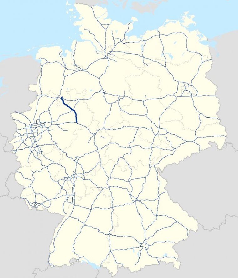
Map of Bundesautobahn 33, Germany. ![]()
Bundesautobahn 33 (Federal Motorway 33, short form Autobahn 33, abbreviated as BAB 33 or A 33) is an autobahn in Germany which connects the Bundesautobahn 30 in the north and the A 44 in the south.
The A 33 begins to the east of Osnabrück in Schinkel, crossing over the A 30 to Osnabrück Süd, running through Georgsmarienhütte, Hilter am Teutoburger Wald, Bad Rothenfelde and Dissen am Teutoburger Wald, ending after around 25 km in Borgholzhausen.
At this point, there are considerable traffic jams on the linking B 68, as the area is not equipped to handle all the incoming traffic from the A 33.
From Halle (Westf.), around 8 km southeast of Borgholzhausen, the A 33 begins a new, running through Bielefeld, Sennestadt, Schloß Holte-Stukenbrock, Paderborn and Borchen before terminating at the Bad Wünnenberg interchange, which joins the A 44 running between Dortmund and Kassel as well as the B 480, which leads on through Brilon in the Sauerland region.
The three different stretches of road are named according to the region in which they are located. The Osnabrück-Bielefeld route is known as the Teutoburger-Wald-Autobahn, the route between Bielefeld and Paderborn, which feeds into the A 2, is known as the Senneautobahn, and the remainder leading through East Westphalia is known as the Ostwestfalenmagistrale.
Between junctions Dissen and Dissen Süd, a tunnel has been built of around 700 m length to protect the surrounding area from the noise.
Length: 94 km (58 mi)
States: North Rhine-Westphalia, Lower Saxony
Source
• www.wikipedia.org
YOU MAY ALSO LIKE


 If you own or manage a travel-related business such as a hotel, a bed-and-breakfast, a restaurant, a pub or a cafeteria, you can create a web page for your business for free on Titi Tudorancea Travel Info. » |