| Published in Tourist Info / Highways |
Autovía A-8, Autovía del Cantábrico, Transcantábrica, Spain
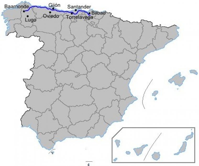
Map of Autovía A-8, Spain. ![]()
The Autovía A-8 is a highway (autovía) that connects all the regions on the Northern Coast of Spain. It is known as the Autovía del Cantábrico (also known as "Transcantábrica") and connects Baamonde (Begonte, Galicia) and Bilbao, where it continues as the Autopista AP-8 to the French border. The road passes Ribadeo, Gijón, Santander and Bilbao.
Currently the A-8 is also the main beltway of the Greater Bilbao conurbation, which has about a million inhabitants in the metropolitan area. This causes great traffic congestion along the stretch of 30 kilometres of the highway that passes by Bilbao and its metropolitan area, from Galdakao to Muskiz.
Length: 486 km (302 mi)
Major cities crossed: Baamonde, Ribadeo, Gijón, Santander, Bilbao.
Junctions
From Bilbao
To Baamonde
Source
• www.wikipedia.org
YOU MAY ALSO LIKE
 If you own or manage a travel-related business such as a hotel, a bed-and-breakfast, a restaurant, a pub or a cafeteria, you can create a web page for your business for free on Titi Tudorancea Travel Info. » |