| Published in Tourist Info / Highways |
Autovía A-4, Autovía del Sur, Spain
The Autovía A-4 or Autopista AP-4 (also called Autovía del Sur that means Southern Autovía) is a Spanish autovía and autopista route which starts in Madrid and ends in Cádiz.
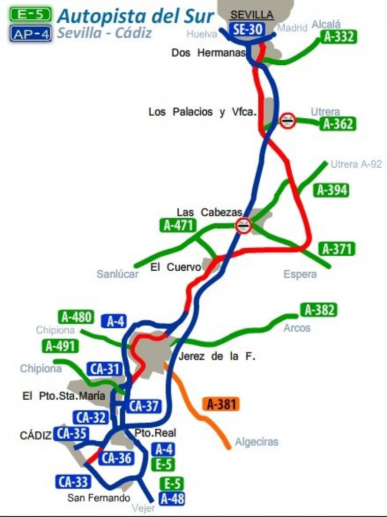
The Autopista AP-4, with toll, (from Seville to Cádiz) has a total length of 123.80 km.
Length: 660 km (410 mi)
Major cities crossed: Madrid, Pinto, Aranjuez, Valdepeñas, Baylen, Andújar, Córdoba, Écija, Carmona, Seville, Dos Hermanas, Puerto Real, Cádiz
Sections
1. From Madrid to Aranjuez. Length: 52.72 km. Designation: A-4
2. From Aranjuez to Ocaña. Length: 14.87 km. Designation: A-4
3. From Ocaña to Madridejos. Length: 56.95 km. Designation: A-4
4. From Madridejos to Manzanares. Length: 57.35 km. Designation: A-4
5. From Manzanares to Valdepeñas. Length: 27.86 km. Designation: A-4
6. From Valdepeñas to La Carolina. Length: 68.20 km. Designation: A-4
7. From La Carolina to Baylen. Length: 26.36 km. Designation: A-4
8. From Baylen to Andújar. Length: 29.64 km. Designation: A-4
9. From Andújar to Córdoba. Length: 77.31 km. Designation: A-4
10. From Córdoba to Écija. Length: 54.13 km. Designation: A-4
11. From Écija to Carmona. Length: 53.88 km. Designation: A-4
12. From Carmona to Seville. Length: 35.18 km. Designation: A-4
13. From Seville to Cádiz. Length: 123.80 km. Designation: AP-4
Source
• www.wikipedia.org
YOU MAY ALSO LIKE
 If you own or manage a travel-related business such as a hotel, a bed-and-breakfast, a restaurant, a pub or a cafeteria, you can create a web page for your business for free on Titi Tudorancea Travel Info. » |


