| Published in Tourist Info / Highways |
A7 motorway, Rijksweg 7, Netherlands
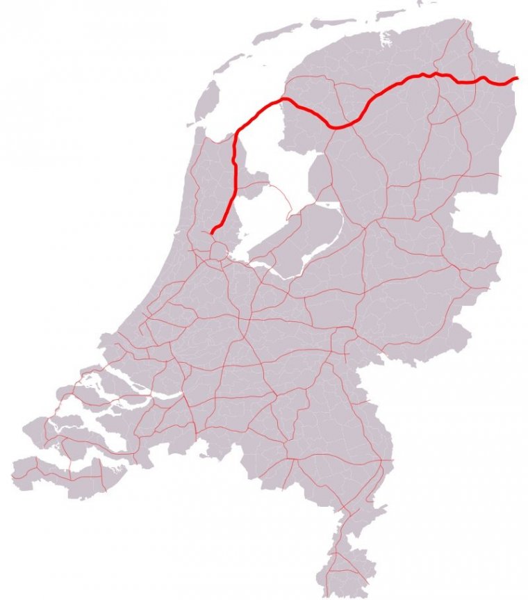
Map of A7 motorway, Netherlands. ![]()
The A7 motorway is a motorway in the Netherlands connecting Zaandam, via the Afsluitdijk, Sneek and Groningen to the German border near Bad Nieuweschans. The entire road is part of the European route E22, with exception of the first kilometre, between the terminus in Zaandam and the interchange Zaandam. With a length of 236 km it is the longest motorway in the Netherlands. It is part of E 22.
The motorway A7 is interrupted twice:
• Around Sneek, the road is demoted to a highway for several kilometres, and includes some at-grade intersections The at-grade intersections were replaced with grade-separated intersections in 2008–2010. However, it isn't a motorway.
• Also, around the city of Groningen, it is demoted over a distance of several kilometres, mainly for the at-grade intersection with motorway A28, and for the road's small alignment through the city in general.
Both of the abovementioned sections are denoted as N7 to distinguish those parts from the motorway, for which the A designation is used in the Netherlands. The A7 together with the N7 is called the Rijksweg 7.
Length: 236 km (146.6 mi)
Junctions
West end: A8 in Zaandam
East end: Bad Nieuweschans A 280 (Bundesautobahn 280) border with Germany
Source
• www.wikipedia.org
YOU MAY ALSO LIKE

 If you own or manage a travel-related business such as a hotel, a bed-and-breakfast, a restaurant, a pub or a cafeteria, you can create a web page for your business for free on Titi Tudorancea Travel Info. » |