| Published in Tourist Info / Highways |
A4 motorway, Rijksweg 4, Netherlands

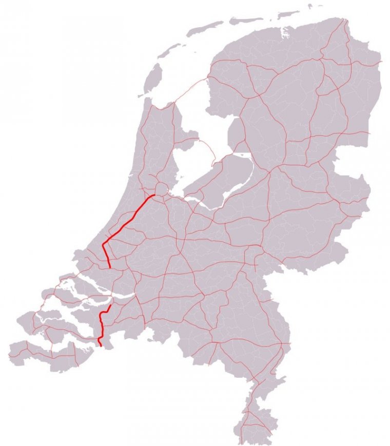
Map of A4 motorway, Netherlands. ![]()
The A4 Motorway, also called Rijksweg 4, is a motorway in the Netherlands, running from Amsterdam southwards through the cities of The Hague and Rotterdam, to the Belgian border near Zandvliet, north of the city of Antwerp.
The A4 is divided into two parts: the first and longest part from Amsterdam to the A15 near the city of Rotterdam. The second part starts near Heijningen, where the A29 and the A4 meet, going to the Belgian border.
Between the A29 near the village of Klaaswaal, south of Rotterdam, and the interchange Sabina, where the A4-A29 meets the A59, the route is numbered A29. Three European routes run concurrent with this highway at some point, E19, E30 and E312. The highway is 119 kilometres (74 mi) long.
There are no authorized plans for the missing link between Pernis (south of Schiedam and west of Rotterdam) and the A29 near Klaaswaal, though right-of-way has been acquired for the future A29 interchange with the A4.
Length: 119 km (74 mi)
Junctions Northern segment
North end: E 19 / E 22 / A10 in Amsterdam
A9 near Badhoevedorp
A5 near Hoofddorp
A44 near Leimuiden
E 30 / A12 near The Hague
E 19 / A13 near The Hague
E 25 / A20 in Rotterdam
South end: A15 in Rotterdam
Junctions Southern segment
North end: A29 / A59 near Heijningen
E 312 / A58 in Bergen op Zoom
E 312 / A58 near Woensdrecht
South end: A12 near Zandvliet (Belgium)
Provinces: North Holland, South Holland, North Brabant
Source
• www.wikipedia.org
YOU MAY ALSO LIKE
 If you own or manage a travel-related business such as a hotel, a bed-and-breakfast, a restaurant, a pub or a cafeteria, you can create a web page for your business for free on Titi Tudorancea Travel Info. » |
