| Published in Tourist Info / Highways |
A2 motorway, Rijksweg 2, Netherlands

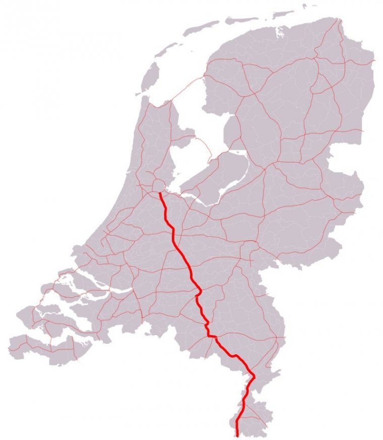
Map of A2 motorway, Netherlands. ![]()
The A2 motorway is a motorway in the Netherlands. It is one of the busiest highways in the Netherlands. The road connects the city of Amsterdam, near the Amstel interchange with the Belgian border, near Maastricht (NL) and Liège (B), and the Belgian A25 road.
The route of the A2 motorway is shared with two major European routes. Between its start, at Amstel Interchange, near Amsterdam, and the Interchange Oudenrijn, near Utrecht, European route E35 follows the A2 motorway. From the Oudenrijn Interchange towards the Belgian border just south of Maastricht, European route E25 follows the route of the A2.
Local and express lanes on A2 have different speed limits. The speed limit on express lanes is 120 km/h (75 mph) and locals is 100 km/h (63 mph).
Length: 217.098 km (134.898 mi)
Junctions
North end: E 19 / E 35 / A10 / S110 in Amsterdam
A9 in Amsterdam-Zuidoost
E 25 / E 30 / E 35 / A12 in Utrecht
E 311 / A27 in Vianen
E 31 / A15 near Deil
A59 in 's-Hertogenbosch
A50 in Eindhoven
E 312 / A58 in Eindhoven
E 34 / A67 in Eindhoven
A73 near Echt
E 314 / A76 near Geleen
South end: E 25 / A25 at Belgium border
Provinces: North Holland, Utrecht, Gelderland, North Brabant, Limburg
Source
• www.wikipedia.org
YOU MAY ALSO LIKE
 If you own or manage a travel-related business such as a hotel, a bed-and-breakfast, a restaurant, a pub or a cafeteria, you can create a web page for your business for free on Titi Tudorancea Travel Info. » |