| Published in Tourist Info / Highways |
A27 motorway, Rijksweg 27, Netherlands

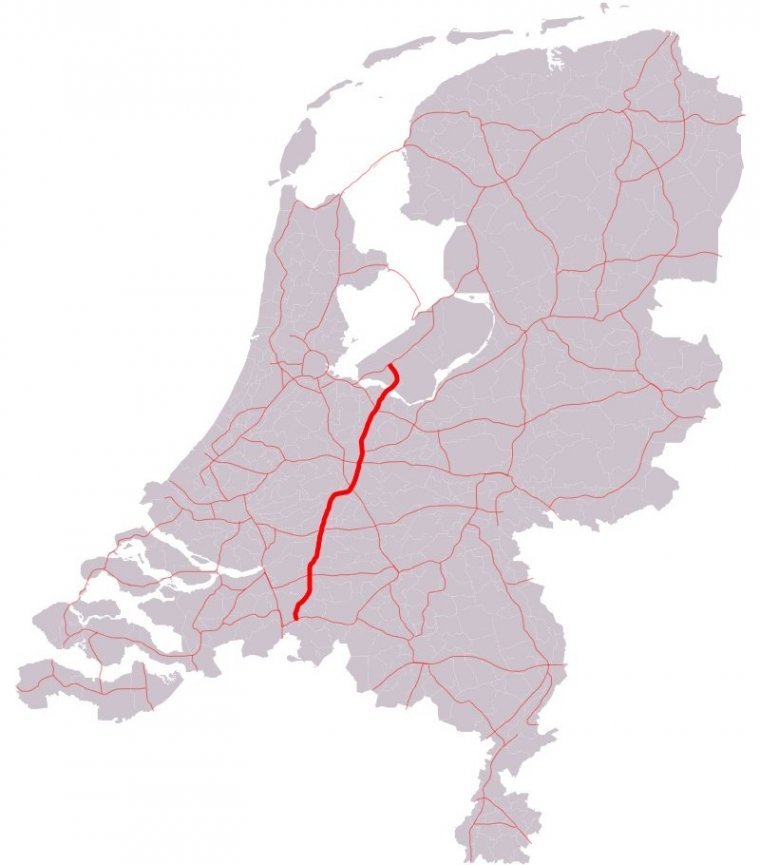
Map of A27 motorway, Netherlands. ![]()
The A27 motorway is a motorway in the Netherlands. It is approximately 109 kilometers in length.
The A27 is located in the Dutch provinces North Brabant, South Holland, Utrecht, North Holland, and Flevoland. It connects the city of Breda with the Almere. On its way, it passes the cities of Gorinchem, Utrecht and Hilversum.
Although not officially a part of the Rijksweg 27, the section of the A58 motorway between interchanges Galder and Sint-Annabosch is also being referred to as A27, next to the road's official reference number A58.
Technically this situation is incorrect, since the A27's official start is only at interchange Sint-Annabosch. However, the reference A27 has probably been added to the road signs to help traffic coming from Antwerp in finding their way from the A16 / E19 towards the A27.
Length: 108.728 km (67.560 mi)
Junctions
South end: E 19 / E 312 / A16 / A58 near Breda
E 312 / E 311 / A58 in Bavel
A59 near Raamsdonk
E 31 / A15 in Gorinchem
E 25 / A2 in Vianen
E 30 / E 35 / E 311 / A12 in Utrecht
E 30 / A28 in Utrecht
A1 / E 231 near Eemnes
North end: A6 in Almere
Provinces: North Brabant, South Holland, Utrecht, North Holland, Flevoland
Source
• www.wikipedia.org
YOU MAY ALSO LIKE
 If you own or manage a travel-related business such as a hotel, a bed-and-breakfast, a restaurant, a pub or a cafeteria, you can create a web page for your business for free on Titi Tudorancea Travel Info. » |

