| Published in Tourist Info / Highways |
A1 motorway, Rijksweg 1, Netherlands

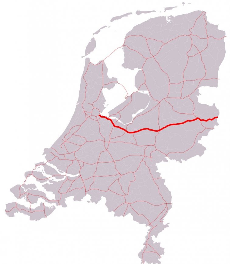
Map of A1 motorway, Netherlands. ![]()
The A1 is a motorway in the Netherlands. The road connects the capital city of Amsterdam, near the interchange of Watergraafsmeer, with the German border, near Oldenzaal and Bad Bentheim, and the German Autobahn BAB 30. On its way, it crosses four provinces: North Holland, Utrecht, Gelderland and Overijssel.
The section of the road between its start at the interchange Watergraafsmeer, and the interchange of Hoevelaken near Amersfoort, is also a European route: the E231. This section of the A1 is the complete E231 route; the E231 does not consist of any other road or section.
Between the interchange Hoevelaken and the German border (and beyond, along the BAB 30), the European route E30 follows the A1 motorway. This European route is a so-called A-Class West-East European route, going from Cork in Ireland all the way to Omsk in Russia.
Length: 119 km (74 mi)
Junctions
West end: A10 in Amsterdam
A9 in Diemen
A6 near Muiderberg
A27 near Eemnes
E 30 / E 231 / E 232 / A28 in Amersfoort
A30 near Barneveld
A50 in Apeldoorn
A35 near Borne
East end: A 30 near Losser at the border with Germany
Provinces: North Holland, Utrecht, Gelderland, Overijssel
Source
• www.wikipedia.org
YOU MAY ALSO LIKE
 If you own or manage a travel-related business such as a hotel, a bed-and-breakfast, a restaurant, a pub or a cafeteria, you can create a web page for your business for free on Titi Tudorancea Travel Info. » |


