| Published in Tourist Info / Highways |
A15 motorway, Rijksweg 15, Netherlands

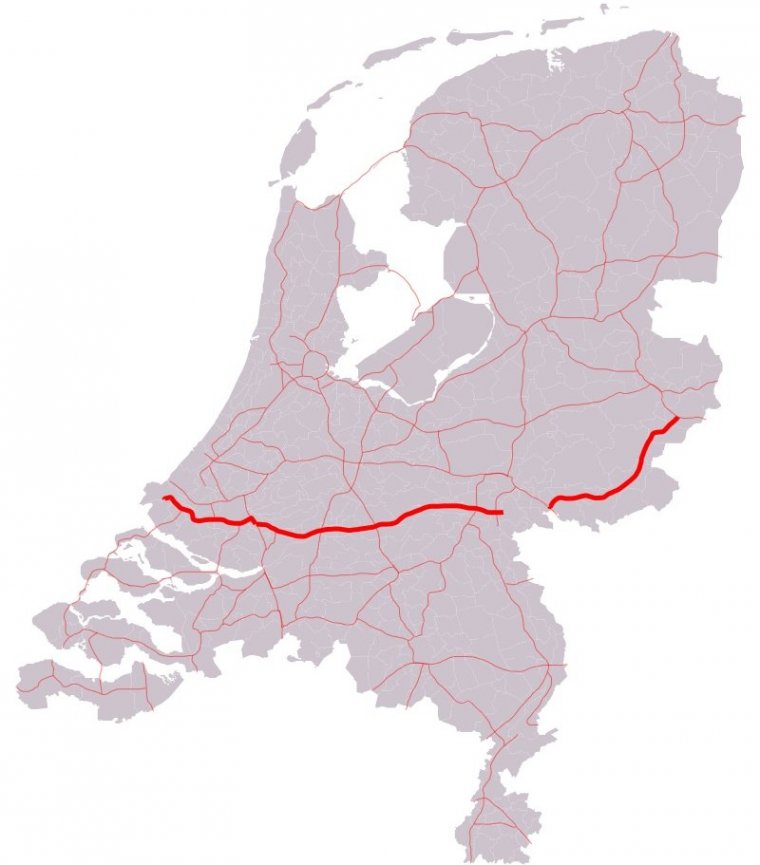
Map of A15 motorway, Netherlands. ![]()
The Dutch A15 motorway (Rijksweg 15) is a set of two motorways in the Netherlands, the A15 and the A18.
In governmental plans, the A15 and A18 together were meant to be one long motorway from the Europoort harbor near Rotterdam towards the town of Varsseveld in the east of the country. However, the section between the interchange Ressen and Zevenaar was not completed.
To avoid confusion for drivers, the eastern part of the road has been given a different number: A18. In 2018, the Dutch government announced plans to extend the A15 by 12 kilometres (7.5 mi) from the A325 south of Arnhem to the A12 northwest of Zevenaar as a toll motorway, which will provide a connection onward to the A18; the A12 will also be widened from Westervoort to the Oud-Dijk interchange with the A18, and a new Zevenaar-East exit will be built to replace the existing Zevenaar exit.
Construction of the extension began in 2019 and is planned for completion between 2021 and 2023. It is unclear whether the A18 route will be renumbered as the A15 once the connection to the A12 is made.
Section A15 (and N15)
The westernmost part of the road, between the Maasvlakte and exit 8 is officially not an Autosnelweg (motorway), and is therefore known as the N15. However, it has most characteristics of a motorway, such as a central barrier and a hard shoulder until it crosses the Coloradoweg on the Maasvlakte. As of exit 8, the road becomes an official motorway, called A15.
Together with the Betuweroute, which runs parallel on several stretches, the A15 is a main transport corridor from the Port of Rotterdam to the east.
Section A18 (and N18)
The A18 motorway is a short motorway, with only 5 exits and 20 kilometers. The western terminus, interchange Oud-Dijk, can only be used by traffic to and from the western part of the A12. Traffic to/from the A12 east of this interchange (most likely from the German BAB 3 road) will have to use local roads to get from the A18 to the A12 or vice versa.
After its eastern terminus near Varsseveld, road number 18 continues as a regional non-motorway road, therefore being called N18. This road passes the towns Harreveld, Lichtenvoorde, Groenlo, and Eibergen on its way to the city Enschede.
Length: 204.150 km (126.853 mi)
Junctions
East end: A325 & N325/S110 west of Het Hoog
West end: N15 south of Rozenburg
Provinces: South Holland, Gelderland
Source
• www.wikipedia.org
YOU MAY ALSO LIKE
 If you own or manage a travel-related business such as a hotel, a bed-and-breakfast, a restaurant, a pub or a cafeteria, you can create a web page for your business for free on Titi Tudorancea Travel Info. » |

